: Note that the warr's flavour in m1 says "...armies
: of The Province" but "...the free cities of
: the North" - free cities is not capitalised, but
: The Province is, so another point imho that the free
: cities were not a kingdom free from the Cath Bruig,
: but simply independant city states not yet conquered
: by the Fallen.
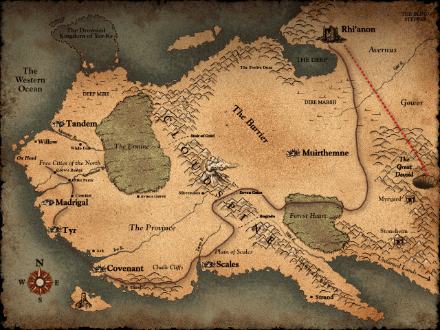
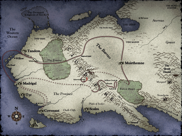
However, on the m1 map, we see "Free Cities of the North" capitalised, meaning that area is officially known as the Free Cities.
Interesting to note that the Free Cities are not labelled on the m2 map as such. Maybe in TFL, the name was official since the war had been going on for 17 years. The name had stuck but the area had shrunk. But, after Balor was defeated and Soublighter returns it was just used to describe the cities not yet conquered by the Dark as in the White Falls journal entry.
Other things I noticed between the two maps include:
The removal of names from Bagrada and Seven Gates (though the Stair of Grief kept its label).
The removal of all the small village names from the beginning of TFL (Crow's Bridge, Otter Ferry, Comfort), as well as the Scamander and Avon's Grove, while the villages we pass through at the start of SB (Willow Creek, Brayle and Tallow) are added.
The area around the Great Devoid has also been shifted slightly to the left while the image depicting it is more like a crater and less like a hole.
Madrigal has of course been changed to ruins and Rhi'anon has been demoted from a fortress to a dot for obvious reasons.

